

“Water Balance & Energy Balance Approaches for Water Resources Management”
Organized by
GIS and Space Applications in Geosciences (G-SAG) Laboratory, NCE in Geology, University of Peshawar & Department of Geology, Fata University
Hosted by
Department of Geography and Regional Planning, University of Balochistan
Date
28th October, 2022
Resource persons:Dr. Muhammad Ali and Mr. Jabir Nazir.
Summary:This seminar was conducted in Department of Geography and Regional Planning, University of Baluchistan for the awareness of the students about how Remote Sensing based Water balance. Students were told about how GIS and Remote Sensing are becoming effective and efficient tools in the exploration, monitoring and mapping of water resources. Uses of GIS and Remote Sensing was one of the main points of the seminar. The resource persons gave lectures regarding the topic of the seminar. Furthermore, students were told about the GIS and Space Applications in Geosciences (G-SAG) Laboratory. The theme of G-SAG was briefly discussed. The lectures included the main aims of GIS and Remote Sensing in the fields of geo-hazard, geological applications, forests and water resources. Figures below are showing some glimpses of the event.
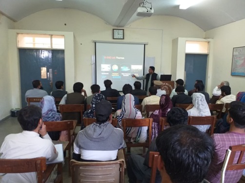 |
Figure 1:Dr. Muhammad Ali lecture during the seminar |